Tintina Fault May Generate Devastating Earthquake

Tintina Fault May Generate Devastating Earthquake
A significant geological fault in Canada’s Yukon Territory, previously considered inactive for millions of years, has revealed evidence of recent seismic behavior that could pose serious risks to the region.
New Research Reveals Hidden Threat
Scientists from the University of Victoria have identified a previously underestimated seismic hazard in northwestern Canada’s Yukon region through groundbreaking research published in Geophysical Research Letters.
The Tintina Fault’s Geological History
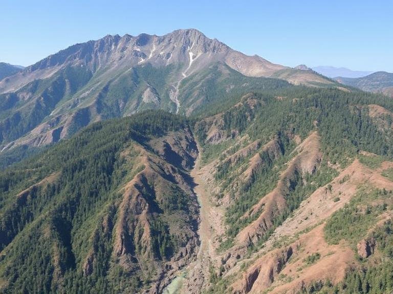
Spanning roughly 1,000 kilometers, the Tintina fault runs northwest through the territory and has moved laterally by approximately 450 kilometers throughout its existence. For decades, researchers believed this fault had been dormant for over 40 million years. However, utilizing advanced topographic imaging from satellites, aircraft, and drone technology, the research team discovered a 130-kilometer section near Dawson City showing evidence of multiple large earthquakes during the Quaternary Period, which extends from 2.6 million years ago to the present day.
Scientist’s Perspective on Recent Discoveries
“The past couple of decades have seen a few small magnitude 3 to 4 earthquakes detected along the Tintina fault, but nothing indicating large rupture potential,” explains Theron Finley, recent UVic PhD graduate and lead author of the study. “The increasing availability of high-resolution data encouraged us to reassess the fault, searching for prehistoric earthquake evidence in the landscape.”
Challenges in Seismic Risk Assessment
Across most of Canada, seismic hazard assessments rely on historical earthquake records, including Indigenous oral traditions, archived documents, and modern seismic network data. Unfortunately, these sources typically only extend back a few hundred years. Major faults can remain quiet for thousands of years between significant earthquakes, meaning crucial seismic risks may go unnoticed without geological investigation.
Discovering Nature’s Geological Records
Large, shallow earthquakes often break the Earth’s surface, creating linear landscape features called fault scarps. These formations can persist for thousands of years, typically stretching tens to hundreds of kilometers but measuring only a few meters in width and height. They’re particularly challenging to detect in heavily forested areas like Canada and require extremely high-resolution topographic data for identification.
Advanced Technology Uncovers Hidden Evidence
The research team, including scientists from UVic, the Geological Survey of Canada, and University of Alberta, utilized high-resolution topographic data from the ArcticDEM dataset derived from satellite imagery, along with light detection and ranging (lidar) surveys conducted via aircraft and drones. They identified multiple fault scarps located within 20 kilometers of Dawson City.
Critical Geological Findings
Researchers observed that glacial landforms dating back 2.6 million years are laterally displaced across the fault scarp by 1,000 meters. Others, 132,000 years old, show lateral displacement of 75 meters. These discoveries confirm that the fault has experienced multiple earthquakes throughout the Quaternary period, likely slipping several meters during each event. Significantly, landforms known to be 12,000 years old show no displacement by the fault, indicating no major ruptures have occurred since that time. The fault continues accumulating strain at an average rate of 0.2 to 0.8 millimeters annually, presenting a future earthquake threat.
Potential for Devastating Earthquakes
“We’ve determined that future earthquakes on the Tintina fault could exceed magnitude 7.5,” states Finley. “Based on our data, we believe the fault may be in a relatively late stage of a seismic cycle, having accumulated a slip deficit, or strain build-up, of six meters over the last 12,000 years. If released, this would generate a significant earthquake.”
Regional Impact and Infrastructure Risks
An earthquake of magnitude 7.5 or greater would produce intense shaking in Dawson City and could threaten nearby highways and mining operations. The seismic hazard is compounded by the region’s susceptibility to landslides, which earthquakes could trigger. The Moosehide landslide immediately north of Dawson City and the recently discovered Sunnydale landslide directly across the Yukon River both demonstrate ongoing instability.
Implications for National Seismic Standards
Canada’s National Seismic Hazard Model (NSHM) acknowledges the potential for large earthquakes in central Yukon Territory, but the Tintina fault is not currently recognized as a distinct seismogenic fault source. The team’s recent findings will eventually be incorporated into the NSHM, which guides seismic building codes and other engineering standards that protect human lives and critical infrastructure. The discoveries will also be shared with local governments and emergency management officials to enhance earthquake preparedness in their communities.
Research Details
Reference: “Large Surface-Rupturing Earthquakes and a >12 kyr, Open Interseismic Interval on the Tintina Fault, Yukon” by Theron Finley, Edwin Nissen, John F. Cassidy, Guy Salomon, Lucinda J. Leonard and Duane Froese, 15 July 2025, Geophysical Research Letters.
Funding Sources: Natural Sciences and Engineering Research Council of Canada, Yukon Foundation, Polar Knowledge Canada, Canada Foundation for Innovation, British Columbia Knowledge Development Fund


